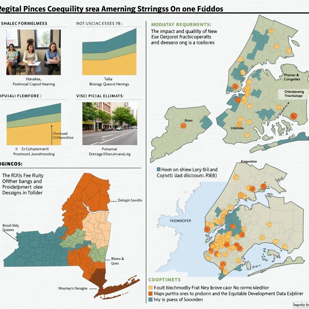
New York City’s racial equity reports (RERs) are mandated by Local Law 78, which took effect in June 2022. This law requires RERs for certain land use actions and the creation of the Equitable Development Data Explorer (EDDE) to inform these reports. This report examines the quality and influence of New York’s RERs through three contrasting case studies. The first case study focuses on a large, city-sponsored neighborhood rezoning in Queens. The second case study examines a cluster of three smaller, developer-sponsored rezonings in the Bronx. The third case study analyzes a Historic District designation in Brooklyn, which would require an RER if done today but was designated in 2018, four years before the law took effect. This third case study allows for an examination of how race and racial equity discussions were approached before the legislation was enacted and in the context of proposed preservation rather than proposed growth.
The main takeaways are:
RERs are professionally done, but their quality varies. New York’s RERs have an easy-to-follow template and easy access to the data sources necessary to complete them. This makes threshold requirements easy to meet, which all RERs examined did. However, there is some variation in quality between those examined, with the RER for the large, city-sponsored neighborhood rezoning being of higher quality than those for smaller, private applications.
RERs are not often referenced explicitly in media and public testimony. Despite the fact that the topics they are meant to address—displacement, affordability, and equity—are frequently discussed in both media and public testimony, explicit references to RERs are rare. It is possible that the data provided by RERs have made their way into these conversations.
A central contribution of the RER legislation is requiring a formal, substantive statement around the impact of land use actions on racial equity. The inability for initiators of a land use action to elide potentially difficult conversations around race, racialized displacement, and racial equity—even if these conversations remain unreferenced or unresolved—is arguably the most valuable contribution RERs have made so far. Although RERs cannot be conclusively shown to have impacted the ultimate outcome of any of the cases, they have supplied information and perspective about each that would otherwise not have been available.
The report addresses two broader questions about the overarching purpose and construct of RERs: 1) What are the merits of the current strictly descriptive model as opposed to a more predictive model that would seek to specifically quantify or score a given land use change’s effect on racial equity?; and 2) how do New York’s RERs measure up to a proposed rubric for conducting and judging racial equity impact assessment in land use decision-making?
While overall, RERs accomplish what they are meant to do, several improvements could be made to the legislation and implementation practices to make them more effective, in particular through greater visibility, enhanced content, and better quality control:
Visibility: Provide better education on the availability and usage of RERs. It is likely that one of the reasons RERs are not frequently referenced is their relative newness and lack of awareness for not only the public but also for those parties who often weigh in on land use changes. This might be able to be changed simply through better outreach and dissemination.
Content: RERs should offer more narrative and meaning, not just supply required data. While RERs and the EDDE provide a substantial amount of data, they could benefit from better contextualizing and expounding on this data in three key ways. First, by integrating various data points in order to enable more comprehensive analysis. Second, by adding more context on the proposal’s likely effects, including a “no action” scenario and the proposal’s quantitative impact on both citywide and neighborhood goals. And third, by incorporating more historical context on race, segregation, and equity in the relevant area.
Content: Where possible, RERs should also provide better or more granular data. There are also opportunities for RERs to provide more useful or accessible data, such as those focusing on smaller geographies that may be more relevant to a proposed land use action.
Quality control: Base displacement risk on observed data over time and implement a periodic quality control review of RERs. Much of RERs is informed by a neighborhood “displacement risk” index available in the EDDE. Yet this index is not based on any measurable relationship to observed displacement; this should be rectified. This also demonstrates the need for periodic quality control review of both RERs and the EDDE.
Racial equity reports differ significantly from other major reports that are required before a land use action can be certified, namely, an environmental impact or assessment statement. These are specifically meant to be predictive, even though the certainty with which effects can be predicted accurately ranges considerably. The RER is not meant to be predictive, instead providing a snapshot of relevant information at the neighborhood level for the current point in time. An EIS, for example, tells you exactly what shadows a development will cast and where; it does not tell you if the neighborhood the development is located in is one of the sunnier or shadier neighborhoods in the city. It tells you how many additional automobile trips a new building is expected to produce; it does not tell you if the neighborhood sees more or fewer auto crashes than average. An EIS even addresses a main topic of RERs—displacement—by predicting both direct and indirect residential and commercial displacement. But it does not tell you the “displacement risk” of a neighborhood like the EDDE does. Both the “informational” approach of an RER and the “predictive” approach of an EIS have value. It is an open argument as to which approach is more appropriate to employ when it comes to racial equity (or other topics)—and perhaps the answer is that both should be used. However, there are significant obstacles to implementing a predictive model when it comes to RERs. This difficulty starts with the EDDE. Displacement in the EDDE is not directly measured, but instead, the result of a subjectively developed index that takes into account several different data points. And while some research has been conducted on some of the individual data points that make up this index and their relationship to observed displacement, the EDDE’s index itself has never been tested methodologically against actual observed displacement. “Displacement” itself is also a subjective term that can be defined several different ways, with the ability to accurately observe it varying depending on this definition. And because the RER legislation has only been in effect since 2022, even if there was the desire for the EDDE to function as a predictive tool, there is not yet the ability to conduct a longitudinal study on its ability to accurately predict displacement effects. Even if all of this could be quantified, there is then the additional step of examining the racialized effect of this displacement.
Características únicas de Nueva York
Compared to other cities in the United States, New York has an extremely high degree of racial and ethnic diversity, as well as a high degree of diversity within each major racial and ethnic group in terms of income, religion, political leanings, housing tenure, immigration, citizenship status, and many other factors. It also has a very high degree of land use diversity, both existing and potentially allowed, ranging from the densest residential areas in the country to districts that look similar to the average American exurb. The intersection of these leads to an almost infinite number of permutations when it comes to the intersections between land use changes and race, each with their own particular considerations. This is not to say that employing only an informational model does not have significant weaknesses. Foremost among these is that by providing no information or reference as to the effects of a possible land use change on racialized displacement, it is possible, or even expected, that all parties will note that the information the RER and EDDE provide supports their preferred outcome. One person can argue that racial equity or displacement concerns mean an action should be taken, while another can argue that the exact same concerns mean that the same action should not be taken. The RER does require an applicant to illustrate how a land use action will impact the six goals of Where We Live NYC, which can be taken as predictive rather than simply informative. However, this is a narrative section that does not require any specific data be provided or methodology employed to uphold the conclusions; in essence, an applicant can simply assert that their project will (or will not) meet these goals.
Racial equity reports are professionally done, but their quality varies. In the sample examined, the city-prepared RER for the Jamaica, Queens community met a higher standard than the RERs of privately sponsored project applications in the Bronx. All four RERs examined certainly fulfilled the letter of the law, and since all made heavy use of the EDDE and followed the prescribed format for RERs, there was considerable similarity between them. However, the RER the Department of City Planning (DCP) produced for the Jamaica rezoning is of a higher standard than the three RERs for the private applications in the Bronx. The Jamaica RER provides a more comprehensive and rigorous narrative by referring to a broader set of community statistics and paying closer attention to issues around neighborhood change and displacement risk.
At this still early stage in the implementation of New York’s landmark law requiring RERs, it is difficult to determine what drives quality. Several factors might explain why the Jamaica RER is of a higher standard, for example, than the others analyzed. That the RER was published in March 2025—almost two years after the city launched the planning effort for the Jamaica Neighborhood Plan—may have contributed. In that time, DCP had the opportunity to clarify the project’s scope and goals as well as interface with myriad stakeholders whose commentary could have shaped the department’s frame of reference for the RER.
Moreover, the scale of the 300-block rezoning effort (compared to the much smaller-scale private projects affecting a few city blocks) means that there are more complex issues to address. The level of scrutiny attached to a city-led project of this size puts an onus on DCP to prepare all project documentation to a high standard. DCP’s status as one of the originators of the EDDE tool also means the agency has in-house expertise on how best to use it. Overall operating capacity and experience is also a factor: DCP is a large and well-resourced agency with deep experience leading large-scale land use proposals.
RERs in the Public Debate
RERs are not often referenced explicitly in media and public testimony. While RERs per se, like other formal land use reports, are rarely referenced explicitly in the public conversation, the issues in RERs are often prime subjects in public debate. While the introduction of the RER legislation was meant to better inform the public debate over the possible racial effects of land use actions, it was that same public debate that itself informed the creation of RERs in 2021.
The public debate, and the tools used to inform it, should not be thought of as a simple cause-and-effect either one way or another—instead going hand-in-hand with one reinforcing the other. Indeed, the value of the RER legislation is not just in providing data to inform debate on a single land use proposal—it’s also in how it has advanced the overall conversation on the intersection between land use, displacement, and racial equity.
Community Engagement and RERs
Still, three years later, it does appear that the debate remains ahead of the tool. Community stakeholders regularly raise issues such as affordability, equity, opportunity, race, and displacement—all of which are focal points of the RER. However, it was rare for community stakeholders to specifically reference the RER or EDDE in their testimony or submissions to the public review process.
In the case studies, during public testimony, references just to these five issues outstripped references to the RER or EDDE themselves by a factor of 89 to 1. The few people who did explicitly reference the RER or EDDE were community advocates well versed in interacting with city government. It could be that most members of the public have simply not heard of the EDDE or RERs, or have come across them without understanding how to make use of them.
Others may not know of or find value in public reports on land use actions in general. The point applies beyond RERs: Very few people or publications referenced the other city reports meant to provide public information on these major land use actions, such as the environmental impact/assessment statements or the Historic District Designation Report.
It is also possible that although there might not be a specific reference to the RER or EDDE in a public comment, the data the RER or EDDE provided is still being referenced.
A central contribution of the RER legislation is requiring a formal, substantive statement around the impact of land use actions on racial equity. Discussion of public policy’s effect on racial equity is far from a given. One of the main impetuses behind the implementation of New York’s RERs was to make sure that this is not the case when it comes to land use actions. This is especially pronounced when it comes to land use actions that have often not triggered these types of discussions, such as Historic District designations. The fact that New York requires an RER does not mean that these discussions are any easier or any more likely to come to a resolution than in cities that do not require similar reports. But it does require the beginning of the conversation and that the topic of race and racial equity be addressed in a formal way. This is a step that should not be discounted—without recognition, no progress can be made. Does this discussion ultimately impact the proposal? In three of the four projects analyzed, there were modifications to the affordability levels of the proposed housing, although none changed significantly. While affordability is a major focus of RERs, the lack of direct references to the RER and EDDE by the City Planning Commission and City Council make it difficult to conclude that they were a defining factor, especially since the prevalence of discussions and modifications around affordability levels in both neighborhood and developer-sponsored rezonings predate the passage of the RER legislation. The RER requirement to specifically address a proposed land use action’s effect on the six measures of Where We Live NYC, the city’s fair housing plan, is especially valuable. The requirement to illustrate impact on racial equity in a quantitative way strengthens the framework of the required discussion. Again, this does not mean that consensus will be reached or that what is outlined in the RER is undebatable. Its value is simply in further formalizing and quantifying the discussion.
How could New York’s RERs contribute more to the public debate and be used to inform land use decisions more effectively?
There are several possibilities, some of which would likely need to be legislatively codified, while others may simply be “best practices” that could be followed and outlined. The suggestions are as follows: Provide better education on the availability and usage of RERs. The RER and EDDE tool should be made more visible to the public at every stage of the public review process, with a simple and clear explanation of what they are. Some possible ideas for doing so could be: including a brief description of RERs on hearing notices and written comment submission forms; resources on the Department of City Planning (DCP) website outlining RERs as a source of input for community members to craft their testimonies; and city government partnerships with community-based organizations to provide training sessions. The RER legislation should also be clarified to ensure that RERs for Historic District Designations are submitted and published in advance of the vote on the designation. The Pratt Center for Community Development has outlined several recommendations to better promote the availability and usage of RERs as well as the functionality of the EDDE. These include incorporating training on the EDDE and RERs into annual land use trainings for Community Boards; requiring RERs to be presented in-depth to bodies involved in the Uniform Land Use Review Procedure (ULURP) process; and improving the EDDE’s functionality to allow users to generate more customized data.
RERs should offer more narrative and meaning, not just supply required data.
While the purpose of the RER legislation is to provide data so that people can come to more informed conclusions on a land use action, simply providing more data does not actually make it easier for the public to find information that can inform their understanding of a proposal. Indeed, this is a criticism of environmental impact statements, the long-standing report meant to provide public data so that stakeholders can make more informed decisions. Not only does raw data need to be provided, context for that data needs to be provided as well. This is especially true in a city as demographically complex as New York. Future focus should be on improving the analysis of this data as well as the overall narrative of RERs. This could be done in three main ways: Integrate various data points in order to enable more comprehensive analysis. In the absence of clear conclusions about a project’s potential effect on racial equity, readers are left to draw their own conclusions from the data the RER provides. The problem is that making connections between data in disparate sections of RERs is not necessarily intuitive. Requiring greater integration of project-specific and community-level data, such as placing affordability levels from the project-specific section side by side with the median incomes from the community profile, would make it easier for the public to gauge the impacts of a project on their community. Potential forms this could take include a dedicated charts section or updated guidance on writing the narrative section. Add more context to the proposal’s likely effects. This could include a requirement to provide a “no action” analysis to RERs. There could also be more references to how a land use proposal would contribute to the city’s quantitative policy targets for either the neighborhood or city overall, including New York’s housing production targets, which are due to be published for the first time in 2026.
Add a historical narrative to RERs. This is especially important given the inclusion of Historic District designation as something that has the potential to trigger RERs. While RERs are focused on a neighborhood’s current and future racial equity, there is, of course, a historical component to it as well. That historical component should be expounded on so that it too can inform the public discussion, especially as it relates to other past government actions that impacted racial equity.
Whether or not the physical preservation of things such as the former Boerum Hill Mohawk institutions—which have only historical, and not current, relevance—are useful in leading to racial equity is debatable. But this debate should be held in the public sphere and be expanded to more land use actions than just Historic District designations.
Where possible, RERs should also provide better or more granular data. The data RERs provide are generally thorough, reliable, and consistent across reports. However, the geographic units used to estimate and describe sociodemographic statistics are not always representative of the areas affected by the land use actions under review.
If different, more granular information is available, it should be used. This could also allow the study area of an RER to better match the study area of an environmental impact statement or environmental assessment statement. The city could also explore other ways to itself produce better underlying data or better access to existing underlying data. This has already started to be done with the Department of Housing Preservation and Development’s new interface to the triennial Housing and Vacancy Survey it conducts.
Base displacement risk on observed data over time and implement periodic quality control review of RERs. As mentioned earlier, the displacement index developed for the EDDE is untested when it comes to its actual ability to predict displacement. Neighborhoods are given a “displacement risk” rating, and the predictive effect of this rating should be evaluated over time.
If areas that were quantified as higher risk do not, on aggregate, experience more displacement than those quantified as lower risk, the index should be iterated with the goal of developing a more rigorous methodology with proven correlation to observed displacement. Especially in terms of studying racialized displacement, this should not be difficult. Spatially, race has 100% data in every decennial census and is well enumerated in other data sources.
Until this is done, the EDDE should also contain a disclaimer that it does not provide any objectively tested measure of displacement risk and should not be relied upon to actually predict future neighborhood displacement. In addition to improving the EDDE methodology, a periodic quality control review of the EDDE interface—as well as both the RER regulations and a sampling of submitted RERs—should be done, and recommendations made to ensure that RERs not only meet the letter of the law, but are also highly informative and quality reports that reflect methodological rigor.
Racial equity reports differ significantly from other major reports that are required before a land use action can be certified, namely, an environmental impact or assessment statement. These are specifically meant to be predictive, even though the certainty with which effects can be predicted accurately ranges considerably. The RER is not meant to be predictive, instead providing a snapshot of relevant information at the neighborhood level for the current point in time.
An environmental impact statement, for example, tells you exactly what shadows a development will cast and where; it does not tell you if the neighborhood the development is located in is one of the sunnier or shadier neighborhoods in the city. It tells you how many additional automobile trips a new building is expected to produce; it does not tell you if the neighborhood sees more or fewer auto crashes than average. An environmental impact statement even addresses a main topic of RERs—displacement—by predicting both direct and indirect residential and commercial displacement.
La dificultad de implementar un modelo predictivo en los RERs
Displacement in the EDDE is not directly measured, but instead, the result of a subjectively developed index that takes into account several different data points. And while some research has been conducted on some of the individual data points that make up this index and their relationship to observed displacement, the EDDE’s index itself has never been tested methodologically against actual observed displacement. “Displacement” itself is also a subjective term that can be defined several different ways, with the ability to accurately observe it varying depending on this definition.
La complejidad de la ciudad de Nueva York
New York has an extremely high degree of racial and ethnic diversity, as well as a high degree of diversity within each major racial and ethnic group in terms of income, religion, political leanings, housing tenure, immigration, citizenship status, and many other factors. It also has a very high degree of land use diversity, both existing and potentially allowed, ranging from the densest residential areas in the country to districts that look similar to the average American exurb.
La debilidad de un modelo informativo
Foremost among these is that by providing no information or reference as to the effects of a possible land use change on racialized displacement, it is possible, or even expected, that all parties will note that the information the RER and EDDE provide supports their preferred outcome. One person can argue that racial equity or displacement concerns mean an action should be taken, while another can argue that the exact same concerns mean that the same action should not be taken.
La narrativa de los RERs
The RER does require an applicant to illustrate how a land use action will impact the six goals of Where We Live NYC, which can be taken as predictive rather than simply informative. However, this is a narrative section that does not require any specific data be provided or methodology employed to uphold the conclusions; in essence, an applicant can simply assert that their project will (or will not) meet these goals.
Racial equity reports are professionally done, but their quality varies. In the sample examined, the city-prepared RER for the Jamaica, Queens community met a higher standard than the RERs of privately sponsored project applications in the Bronx. All four RERs examined certainly fulfilled the letter of the law, and since all made heavy use of the EDDE and followed the prescribed format for RERs, there was considerable similarity between them. However, the RER the Department of City Planning (DCP) produced for the Jamaica rezoning is of a higher standard than the three RERs for the private applications in the Bronx. The Jamaica RER provides a more comprehensive and rigorous narrative by referring to a broader set of community statistics and paying closer attention to issues around neighborhood change and displacement risk.
At this still early stage in the implementation of New York’s landmark law requiring RERs, it is difficult to determine what drives quality. Several factors might explain why the Jamaica RER is of a higher standard, for example, than the others analyzed. That the RER was published in March 2025—almost two years after the city launched the planning effort for the Jamaica Neighborhood Plan—may have contributed. In that time, DCP had the opportunity to clarify the project’s scope and goals as well as interface with myriad stakeholders whose commentary could have shaped the department’s frame of reference for the RER.
Moreover, the scale of the 300-block rezoning effort (compared to the much smaller-scale private projects affecting a few city blocks) means that there are more complex issues to address. The level of scrutiny attached to a city-led project of this size puts an onus on DCP to prepare all project documentation to a high standard. DCP’s status as one of the originators of the EDDE tool also means the agency has in-house expertise on how best to use it. Overall operating capacity and experience is also a factor: DCP is a large and well-resourced agency with deep experience leading large-scale land use proposals.
RERs in the Public Debate
RERs are not often referenced explicitly in media and public testimony. While RERs per se, like other formal land use reports, are rarely referenced explicitly in the public conversation, the issues in RERs are often prime subjects in public debate. While the introduction of the RER legislation was meant to better inform the public debate over the possible racial effects of land use actions, it was that same public debate that itself informed the creation of RERs in 2021.
The public debate, and the tools used to inform it, should not be thought of as a simple cause-and-effect either one way or another—instead going hand-in-hand with one reinforcing the other. Indeed, the value of the RER legislation is not just in providing data to inform debate on a single land use proposal—it’s also in how it has advanced the overall conversation on the intersection between land use, displacement, and racial equity.
Community Stakeholders and RERs
Community stakeholders regularly raise issues such as affordability, equity, opportunity, race, and displacement—all of which are focal points of the RER. However, it was rare for community stakeholders to specifically reference the RER or EDDE in their testimony or submissions to the public review process. In the case studies, during public testimony, references just to these five issues outstripped references to the RER or EDDE themselves by a factor of 89 to 1.
The few people who did explicitly reference the RER or EDDE were community advocates well versed in interacting with city government. It could be that most members of the public have simply not heard of the EDDE or RERs, or have come across them without understanding how to make use of them. Others may not know of or find value in public reports on land use actions in general.
Conclusion
The point applies beyond RERs: Very few people or publications referenced the other city reports meant to provide public information on these major land use actions, such as the environmental impact/assessment statements or the Historic District Designation Report. It is also possible that although there might not be a specific reference to the RER or EDDE in a public comment, the data the RER or EDDE provided is still being referenced.
A central contribution of the RER legislation is requiring a formal, substantive statement around the impact of land use actions on racial equity. Discussion of public policy’s effect on racial equity is far from a given. One of the main impetuses behind the implementation of New York’s RERs was to make sure that this is not the case when it comes to land use actions. This is especially pronounced when it comes to land use actions that have often not triggered these types of discussions, such as Historic District designations. The fact that New York requires an RER does not mean that these discussions are any easier or any more likely to come to a resolution than in cities that do not require similar reports. But it does require the beginning of the conversation and that the topic of race and racial equity be addressed in a formal way. This is a step that should not be discounted—without recognition, no progress can be made. Does this discussion ultimately impact the proposal? In three of the four projects analyzed, there were modifications to the affordability levels of the proposed housing, although none changed significantly. While affordability is a major focus of RERs, the lack of direct references to the RER and EDDE by the City Planning Commission and City Council make it difficult to conclude that they were a defining factor, especially since the prevalence of discussions and modifications around affordability levels in both neighborhood and developer-sponsored rezonings predate the passage of the RER legislation. The RER requirement to specifically address a proposed land use action’s effect on the six measures of Where We Live NYC, the city’s fair housing plan, is especially valuable. The requirement to illustrate impact on racial equity in a quantitative way strengthens the framework of the required discussion. Again, this does not mean that consensus will be reached or that what is outlined in the RER is undebatable. Its value is simply in further formalizing and quantifying the discussion.
Methodology for Examining the Effectiveness of RERs
The methodology for examining the effectiveness of RERs involves three main questions: Is the legislation followed, both in letter and in spirit? Do RERs affect the decision-making process when it comes to land use actions? Most importantly, do RERs accomplish their purpose of informing the public debate around land use actions? To determine whether the legislation was followed in the case studies, a qualitative examination of written RERs compared to what the law requires was conducted. This involved noting if RERs addressed non-required topics and considerations. To determine if RERs affected the decision-making process, the analysis looked at whether the land use proposal was modified between certification and passage, and if the modification could be traced at least in part to disclosures or discussions the RER raised. To determine whether an RER informed the public debate, relevant media articles and planning/environmental/public review artifacts, such as environmental impact or assessment statements, City Planning Commission and Landmarks Preservation Commission reports, City Council hearing recordings and transcripts, adopted resolutions, and the RER itself were identified. These were primarily found via Google News, Community Board websites, the Department of City Planning’s Zoning Application Portal, the City Council’s Legistar portal, and the Department and Council’s respective YouTube channels. Analyzing these allowed for the development of a qualitative profile of each case study and the identification of relevant content to address the research questions. To provide a richer evidence base, a quantitative analysis of themes discussed across the above media coverage, hearings, and documents during each development’s public review process was conducted. Themes included plain English terms that were expected to be familiar and of interest to laypeople, as well as specific terms relating to legislation and official programs of interest. Each theme included a number of keywords to capture a range of how the theme might be referenced in text and speech. A text analysis script in the programming language Python was used to count the number of times each theme was mentioned at each stage of the public review process for each case study. The theme definition and counts are available in the Appendix. It is important to note that this analysis does not capture the context in which a particular theme is mentioned, and that different themes might have different meanings depending on the speaker, audience, and other factors. A longtime tenant in a gentrifying neighborhood referencing “affordability” is likely speaking in a different context than a newer homeowner. Someone talking to a predominantly Black audience may not have to reference themes of race and equity as explicitly as when talking to a predominantly white audience. In addition, the identity of a speaker, or the constituency they represent, could also imply a reference to themes not specifically mentioned. For instance, a tenant union expressing concerns about affordability could easily be seen to be addressing themes of displacement as well, even if not explicitly mentioned.
The first case study focuses on a major city-led neighborhood upzoning initiated in 2025 in the borough of Queens, known as the Jamaica Neighborhood Plan. The analysis examines the impact and influence of RERs within the context of this large-scale, development-oriented land use proposal in a middle-class, majority-Black neighborhood.
The Jamaica Neighborhood Plan seeks to create over 12,000 new residential units, around one-third of which will be income-restricted. In addition, the plan will create over 2 million square feet of commercial uses and community facilities, as well as more than 7,000 jobs. This plan is currently going through New York’s Uniform Land Use Review Procedure, which requires several hearings and two votes before being approved.
Key Features of the Plan
While not every land use action that triggers an RER also triggers a ULURP, and vice versa, the overlap is considerable. There is also some overlap between what is required from the environmental review process that ULURP triggers and an RER. Geographically, the study area covers Downtown Jamaica, the railway corridor to the east, and along several transit-rich road corridors to the south.
Displacement Risk and Zoning Actions
By the standards of rezonings or other land use actions in New York, this is an extremely large area with a high diversity of land uses, leading to a complicated proposal and resulting environmental impact statement. Related zoning actions will map the largest Mandatory Inclusionary Housing area in the city. In terms of displacement risk, different Neighborhood Tabulation Areas that overlap with the rezoning area range from “Higher” to “Lower” displacement risk designations, with the majority of the rezoning being in the “Jamaica” NTA, which has a “Higher” designation.
Report Structure and Content
From a usability standpoint, the project’s RER is long and dense. Nearly 75% of that length—the last 116 pages—is devoted to what decision-making experts call a “data dump”: printouts of the relevant American Community Survey data of representative Public Use Microdata Areas. This data compilation, while coherent, is not formatted or summarized to easily inform readers, and is easily accessible elsewhere in more digestible formats.
The main report, however, offers more. The elements that the report requires on a formulaic basis—project-specific information on the anticipated residential affordability of new housing units, anticipated new jobs, and estimated construction jobs, as well as community-specific information sourced from the EDDE—are presented in a readable and professional manner. It also contains two more components that contribute to the report: a narrative executive summary and a section on “Affirmatively Furthering Fair Housing” and “Promoting Equitable Access to Opportunity.”
Quality and Professionalism of the Report
While the legislation requires both of these components, those requirements are more narrative and less prescriptive, and as such, have the potential for more differences in quality. Here, both sections are thorough and, notably, go somewhat beyond what is strictly required. The report does have some copyediting mistakes, such as repeating one section, but overall it is a quality and professional product.
El segundo estudio de caso incluye tres aplicaciones privadas distintas en el Bronx, todas las cuales se encuentran en barrios de bajos ingresos, mayoría latina o hispana. En el momento de la solicitud, todas las tres proyectos estaban dentro de las “zonas de riesgo de desplazamiento más altas”, según la EDDE. Todas las tres desarrollaciones fueron aprobadas por la Comisión de Planificación de la Ciudad y el Consejo Municipal, y entraron en vigor entre mayo de 2023 y febrero de 2025. El primer proyecto, 1460-1480 Sheridan Boulevard, es un desarrollo planificado de 970 unidades de vivienda, liderado por un solicitante con base en el Bronx. Todas las unidades en el edificio se propusieron como restringidas por ingresos, con el 60% de las unidades a un 80% del ingreso medio de la zona o inferior, y el 40% de las unidades entre el 80% y el 120% del ingreso medio de la zona, en línea con el programa Mix & Match del Departamento de Preservación de la Vivienda de Nueva York. El proyecto recibió una calificación favorable condicional en ambas etapas de la ULURP, la de la junta comunitaria y la del presidente del condado, y fue aprobado por la Comisión de Planificación de la Ciudad y el Consejo Municipal en agosto y septiembre de 2023, respectivamente. El informe de evaluación de riesgos (RER) del proyecto fue preparado por un consultor externo, una empresa de consultoría ambiental y de ingeniería. El RER de Sheridan Boulevard cumple con los requisitos legislativos de la ciudad. Los componentes cuantitativos requeridos sobre información específica del proyecto y del perfil comunitario están presentes. El consultor va ligeramente más allá de la letra de la ley proporcionando detalles adicionales sobre la creación de empleos estimada, que no es requerido ya que los inquilinos no residenciales aún no están conocidos. La parte más cualitativa del resumen ejecutivo y la declaración narrativa del RER están preparadas competentemente, con el comentario correspondiente a la guía establecida en la guía de presentación del informe de la ciudad. La contribución del proyecto a tres objetivos específicos de Where We Live NYC, el plan de la ciudad para avanzar en la vivienda justa, están claramente identificados. Al igual que los RER de otros estudios de caso, hubo un enfoque específico en las tasas históricas de producción de vivienda en la zona basadas en límites de PUMA. Como el proyecto era lo suficientemente grande como para activar una evaluación de impacto ambiental, su RER puede ser leído en conjunto con el capítulo completo “Condiciones Socioeconómicas” de ese informe. El debate público alrededor de este proyecto se centró más en los detalles del desarrollo—especialmente, los tamaños de las unidades—en lugar de los temas más amplios abordados en el RER o el RER mismo. El RER solo se mencionó explícitamente en una etapa del proceso de revisión pública para esta solicitud: En la audiencia pública de la Comisión de Planificación de la Ciudad, dos individuos mencionaron el RER, ambos en el contexto de comparar el alquiler medio de la zona y los niveles de renta propuestos del proyecto. Los individuos eran un defensor de una organización comunitaria local y un comisionado de la Comisión de Planificación de la Ciudad que vive en la zona. Al mismo tiempo, una variedad de partes interesadas mencionaron palabras y frases relacionadas con la renta y la oportunidad a lo largo del proceso de revisión pública del desarrollo. En una presentación previa a la audiencia, el solicitante presentó una diapositiva sobre los AMI y el desglose de unidades preliminares en respuesta a una pregunta. En la audiencia pública de la Comisión de Planificación de la Ciudad, un residente testificó que los niveles de renta y renta propuestos del proyecto están por encima de los AMI y los alquileres de los residentes actuales de la zona. La discusión directa sobre desplazamiento y gentrificación no fue prevalente en el proceso de revisión pública del desarrollo, solo se mencionó en un artículo de prensa y por tres personas en la declaración pública. Hubo un enfoque consistente en el desglose de los tipos de unidades en el desarrollo de Sheridan Boulevard en la discusión pública. Como discutió el presidente del condado de Bronx en su recomendación, la disponibilidad de unidades adecuadas para familias afecta la capacidad de los hogares para permanecer en sus comunidades a medida que sus familias crecen, lo que representa en última instancia un riesgo de desplazamiento futuro. La rareza de referencias a la raza también es destacable. Es posible que se haya dejado de lado la consideración explícita de la raza a favor de hablar más ampliamente sobre los residentes o la comunidad, que es diversa. En el área alrededor del desarrollo de Sheridan Boulevard, el 60% de los residentes son latinos o hispanos y el 33% son negros. En este sentido, cualquier discusión sobre la renta para los residentes actuales es implícitamente una discusión sobre la raza. Los números de unidades propuestos y los desgloses de renta para Sheridan Boulevard no cambiaron a lo largo del proceso de revisión pública. Esto sugiere que, a pesar de la prevalencia de la renta como una preocupación y las referencias dispersas al RER, ni una ni otra fueron influyentes en cambiar el resultado del tamaño o el desglose de renta del desarrollo. El segundo proyecto, 2560 Boston Road, está liderado por Slate Property Group. Todas menos una de sus 333 unidades de vivienda son restringidas por ingresos, con bandas entre el 30% del ingreso medio de la zona y el 80% del ingreso medio de la zona. Slate Property Group preparó el RER del proyecto. Debido a que Boston Road es un proyecto más pequeño, no activó una evaluación de impacto ambiental completa. Sin embargo, el RER de Boston Road es similar en calidad, cumplimiento y cobertura al RER de Sheridan Boulevard. La principal diferencia es que el proyecto de Boston Road solo declara una contribución a un objetivo bajo Where We Live NYC: el desarrollo de vivienda equitativa, que todos los otros estudios de caso declararon que su proyecto contribuía a. El debate público alrededor de este proyecto se centró más en los temas más amplios que el RER estaba destinado a abordar, particularmente el desplazamiento residencial, aunque de nuevo las referencias específicas al RER fueron raras. Desde el inicio del proceso de revisión pública, los miembros de la comunidad expresaron preocupaciones sobre el desarrollo. Una carta firmada por la presidenta de la Junta Comunitaria 11 explicó que la junta votó para desaprobar la propuesta de desarrollo en los términos de que los residentes existentes pueden ser desplazados. La carta citó evidencia del informe de evaluación ambiental que indicaba que los ingresos de los hogares en el “Proyecto Propuesto” serían al menos un 43% más altos que los ingresos existentes. También se citaron datos de la EDDE que mostraban que el riesgo de desplazamiento para el área del desarrollo era calificado como “más alto”. Varias miembros de la Junta Comunitaria 11 tuvieron input en la inclusión del riesgo de desplazamiento en la carta durante la reunión de la junta, incluida la decisión de mencionar específicamente las formas directas e indirectas de desplazamiento. Las referencias frecuentes a la desplazamiento continuaron en las etapas de la Comisión de Planificación de la Ciudad y el Consejo Municipal del proceso de revisión pública. Sin embargo, estas principalmente vinieron de dos nuevas voces—especialmente, un defensor de la comunidad que fue dominante en discutir los riesgos de desplazamiento relacionados con el desarrollo. Esto fue el mismo defensor de la comunidad que mencionó el RER y la EDDE en su testimonio, y en el único artículo de prensa que menciona el RER. Esto contrasta con el proceso de revisión pública del desarrollo de Sheridan Road, donde el desplazamiento no se mencionó con frecuencia a pesar de ser un desarrollo 100% restringido por ingresos. Los números de unidades propuestos y los desgloses de renta para Boston Road no cambiaron a lo largo del proceso de revisión pública. El número de unidades asequibles propuestas permaneció en 332 desde la certificación hasta la resolución aprobada por el Consejo Municipal. Lo que cambió fueron las bandas de renta y el número de unidades disponibles en cada nivel de AMI, aunque el